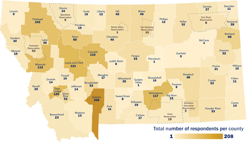
While working for MSU Extension I created this map to display county data for a research study. The shading of each county directly corresponds to the number of respondents to the study survey. I illustrated the map and county lines (including tribe reservations shown with dashed lines) to create this custom illustration. The color palette is tints of shades of the MSU Extension brand colors (blue and gold).